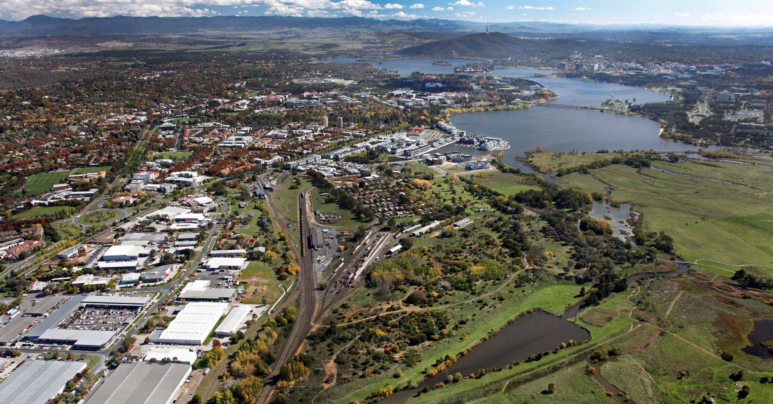
The good news on the East Lake Place Plan is that it greenlights redevelopment of this inner-south brownfield, with sites for the first of thousands of much-needed new homes scheduled for release in 2025-26, two decades after the area was originally identified for residential densification.
The bad news is that on transport the Place Plan delivers rhetorical – ‘multi-modal’, ‘aspirational’ – not practical outcomes:
- It fails to provide an actionable roadmap for serving not only East Lake but developments further east, including Dairy Road, by Canberra’s rapid public transport network.
- It proposes likely wasteful spending to shift the heavy rail terminus a mere 100 metres or so to the east, ignoring longer-term plans for rail between Canberra and Sydney, including the ACT Government’s own transport strategy.
- It discourages innovative mixed-use development in Fyshwick and East Lake itself by retaining the heavy rail line that forms a barrier along the proposed development spine.
The proposed new railway station or ‘multi-modal transport hub’ will support no more than what we have today – infrequent and low-capacity heavy rail to Sydney that connects with a couple of regional road coach services, poorly integrated with Canberra’s public transport network. And a railway museum.
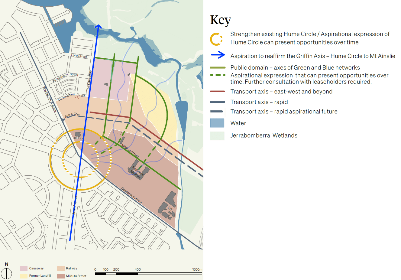
How to integrate East Lake with the rapid public transport network?
The Place Plan says ‘an accessible multimodal transport hub will connect the four areas of East Lake together and connect East Lake to all of Canberra. The area will include bike parking to ease connections to the local rapid transport network and active travel networks’ (Place Plan Part 02, p. 57).
Yet the transport hub won’t even accommodate the rapid network until such time as the latter is delivered by light rail, described as an ‘aspirational future’ state (Place Plan Part 02, p. 61). If this doesn’t happen by the time the transport hub is operational, it will be further from the rapid bus network than the existing station.
Aside from light rail, the Place Plan fails to explore how to better service East Lake and the Dairy Road precinct with buses, either rapid or local.
This follows conditional development approval for the first residential development further east in the Dairy Road precinct (for more than 400 units), despite Dairy Road having no public transport and no concrete plans to provide it.
Fixing the rail connection
Until the arrival of light rail, how can the connection between the heavy rail service and the R2 bus service be improved? Perhaps leave the rail station where it is and provide an accessible and legible pedestrian connection.
The station is only about 250 and 150 metres from the north and southbound Wentworth Ave bus stops respectively, but the only way to walk between the stops and the station is through the busy carpark, with the risk of being run over by cars backing out of parking spaces. And, for the northbound stop, you need to cross Wentworth Ave without signals.
(At the other end, Sydney Central, local public transport services are at least as far if not further from the regional and interstate platforms, but they are accessible.)
Some R2 services detour into the carpark to connect with trains, but how this works is confusing both online and at the station, and you still need to cross the carpark. There is no sign or information at the station, and the timetable displayed at the carpark stop doesn’t point to frequent services on nearby Wentworth Ave if you want to catch a bus when the carpark stop isn’t serviced or the scheduled bus doesn’t turn up. And the trains are regularly delayed, rendering scheduled connections pointless.
The southbound detour is pointless in any event, as the detour stop is no more accessible than the risk-free stop on Wentworth Ave.
Some passengers don’t take the risk and use the Wentworth Ave stops. This could be made safe and convenient (including by installing traffic signals on Wentworth Ave), and the confusing and service-disrupting detour dropped.
How does the East Lake plan work for faster rail?
The Place Plan says its implementation will include ‘Planning for future interstate passenger rail requirements and improving connections with ACT’s transport network’ (Place Plan Part 01, p. 8). ‘An upgraded station can also accommodate a faster rail link’ (Place Plan Part 02, p. 57).
Yet this ignores the ACT Transport Strategy 2020, which provides for a high-speed rail corridor from the north through the Majura Valley to Canberra City or the airport (p. 23, map 1), saying the ‘ACT Government has commenced corridor preservation for a high-speed rail service into the ACT and will reflect this in its future planning’ (p. 31).
This alignment is reflected in proposals by Fastrack Australia and other groups.
The existing rail alignment from Goulburn via the east of Lake George is a legacy of the 19th century pastoral industry, built before the national capital was conceived. It allowed early Canberra to be inexpensively connected to the rail network with a 10 km branch line. No one would replicate this if starting afresh, just as no one would build a motorway to Sydney via the Molonglo Gorge.
Of course, the ACT government can’t do much on its own to provide for faster rail services between Canberra and Sydney. And there is no prospect of light rail reaching East Lake or further until it reaches both Woden and Belconnen, which will be at least 15 years away.
So why does the ACT Government prematurely rule out replacing the heavy rail corridor through Fyshwick with light rail? And why spend money to move the station just 100 metres?
Place Plan priorities include to ‘co-locate the railway museum with an upgraded railway station to allow this important community asset to thrive and tell the rail history of the area’.
But it’s not obvious why the optimal location of the rail station in the medium or long term should be compromised by the desire for a new rail museum. And the risk of such an investment being literally stranded is high in the event of a new fast rail line into Canberra from the north.
It’s unlikely the existing heavy rail corridor to Goulburn would be maintained in the long term purely for use by the rail museum. On the other hand, the existing line could be repurposed for light rail to Queanbeyan, the Kowen Plateau in the ACT (identified for long-term urban expansion), the Defence operational headquarters and Bungendore.
The existing station is adequate to serve current rail needs. The NSW government appears to have no plans to increase the capacity or frequency of the existing rail service beyond the current 3-car, 3-times-daily service in each direction. Even if the new regional trains on order would allow services to be doubled and capacity increased by another carriage, the existing facilities could be upgraded as necessary without the expense of moving the station.
Simply moving the overnight stabling of trains (currently between the station and Canberra Ave) either back to or just east of the station would allow partial extension of The Causeway (street) and the development of most of the block this would create (including for the proposed early childhood and primary school).
The long-term cost of maintaining heavy rail in the inner south
The Fyshwick Business Association’s Eastwick proposal for a mixed-use development served by light rail running along the existing rail corridor envisages the heavy rail station being moved to the east of Fyshwick.
In releasing the Place Plan, this was rejected by the Planning and Transport Minister Chris Steel, who said ‘We still want to see that heavy rail corridor and a station being provided in a central area like Kingston for the Canberra community to access’.
In fact, Kingston, while convenient for inner-south locals like me, isn’t particularly central.
Unlike light rail, heavy rail forms a barrier to integrated development. That’s why the NSW Government replaced the existing heavy rail line into the Newcastle CBD with light rail.
At-grade intersections with heavy rail are no longer generally accepted in Australia. To bridge the heavy rail line, costly overpasses or underpasses would be needed along the rail line. The Place Plan identifies three such crossing points in East Lake alone.
A valuable knowledge base
The East Lake Place Plan captures and documents the precinct’s cultural and environmental character and values, providing a valuable knowledge base to inform redevelopment. And it effectively provides a masterplan for residential expansion at the Causeway, connected to the Kingston Foreshore.
But until a viable role for both heavy and light rail has been identified, the first residential stage will remain isolated from the proposed business, trading and innovation hub along Mildura Street. This is tolerable so long as we don’t waste money on fiddling with the existing infrastructure.
Mark Dando is a current member of PTCBR and a former PTCBR Committee Member.